
Atlas 2020
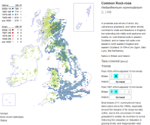
Atlas 2020 is the BSBI's third project to map the distribution of plants across all of the UK and Ireland. The first two atlases were published in 1962 and 2002, and the changes they illustrate over a 70-year period of recording make for fascinating, if all too often depressing, reading.
Many of the BSBI's members have spent much of their time over the last 10 years working their way across the nations, recording native and introduced plants growing in the wild on a systematic pattern based on the Ordnance Survey National Grid. Recording finished at the end of 2019, and the main task since has been to validate records, analyse them and publish the findings. This is now complete; and again, the news for the native British flora is not good.
As well as the massive, two-volume printed book Plant Atlas 2020, there is an even more comprehensive online edition with many additional non-native species and extra information in each species account.
In Hampshire, many people have submitted records over the last decade, and some have supplied many tens of thousands. The vice-county recorders would like to thank you all for your contributions. Now that the project has finished, we shall not be providing the detailed maps and listings that were on the old web site to help you in the recording process.


