Axiophyte mapping in Hampshire
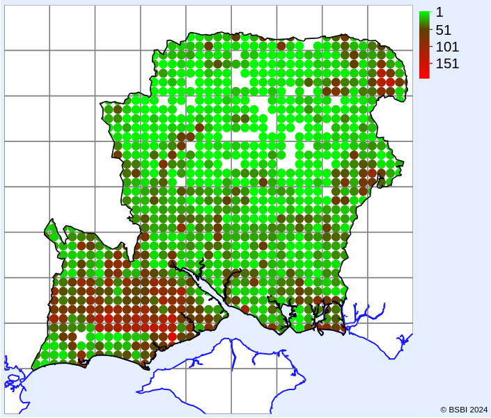
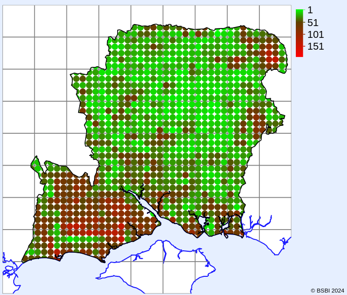
This pair of maps compares the recorded occurrence of Hampshire axiophyte species between two 25-year periods. The first of these included much of the recording done for the 1996 Flora of Hampshire and all the recording for BSBI Atlas 2000. Recording was done at tetrad (2km x 2km) resolution except for scarcer plants, and was not comprehensive for many less interesting areas of North Hampshire (white regions of the map). The second period has included all the recording for Atlas 2020 and data from several other recording schemes. Much of the recording was done at monad (1km x 1km) resolution in this period, but has been aggregated to tetrads for the purposes of a meaningful comparison. Most of the recording gaps have now been filled in at the tetrad level.

Heat map of axiophytes recorded 1975-1999

Heat map of axiophytes recorded 2000-2024
This shows the much more consistent recent coverage across North Hampshire, but not surprisingly in this heavily agricultural area does not reveal any unknown hotspots for native plant diversity. In the south-west the New Forest remains supreme, but targeted recording has shown that the north of the Forest is as diverse as much of the rest. The areas of the Thames Basin and Wealden Heaths retain their importance and also show the benefits of fuller coverage.
Elsewhere, the major river valleys maintain their importance and many relatively built-up stretches of the coastline prove to be as good as some of the more natural habitat.


